Drone Photography vs Rendering for Real-Estate Presales and Site Marketing
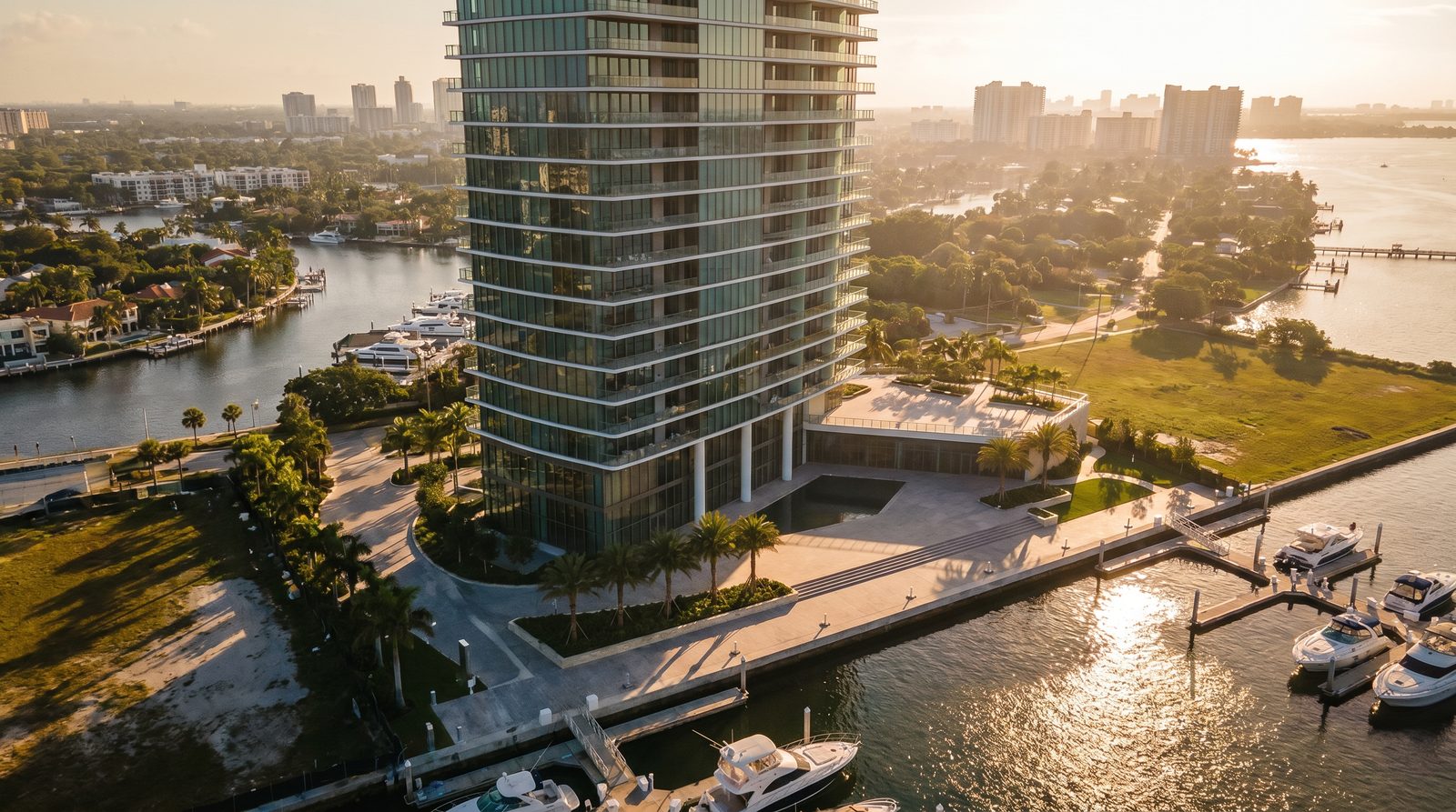
Drone photography captures what exists today; architectural rendering shows what will exist after construction. For presales and pre-construction marketing, rendering is the only viable option because the building does not yet exist. For completed projects, drone photography documents the real site while rendering can still show idealized conditions — perfect lighting, staged interiors, and landscaping at full maturity — that a drone cannot capture on any given shoot day.
Ratio Visuals' take: The most common mistake we see developers make is waiting until construction is complete before commissioning visuals. By that point, drone photography is finally possible — but the presale window has closed. Rendering is not a substitute for drone photography; it is what you use while the drone has nothing to photograph yet.
What is the core difference between drone photography and architectural rendering?
Drone photography uses a camera-equipped unmanned aircraft to capture real, existing structures and landscapes from the air. Architectural rendering is a computer-generated image produced from design files — no physical structure required. The two tools answer different questions: drone photography documents reality; rendering communicates intent.
For a developer marketing a tower that breaks ground next quarter, drone photography of an empty lot tells buyers nothing. A photorealistic real-estate rendering showing the finished building in context — correct height, materials, landscaping — gives buyers something to commit to.
Drone photography vs rendering: side-by-side comparison
| Factor | Drone Photography | Architectural Rendering |
|---|---|---|
| Requires completed structure | Yes — photographs what exists | No — works from drawings and design files |
| Best use case | Completed projects, site context, progress documentation | Presales, pre-construction marketing, investor decks, planning approvals |
| Regulatory requirements (US) | FAA Part 107 Remote Pilot Certificate; LAANC authorization near airports; 400 ft altitude limit | None — produced entirely in software |
| Weather / timing dependency | High — wind, rain, restricted airspace, and time of day all affect the shoot | None — lighting, season, and time of day are chosen by the studio |
| Control over final image | Limited — you photograph what is there | Complete — materials, landscaping, sky, people, and cars are all art-directed |
| Turnaround | Fast once the shoot happens (hours to days for editing) | Days to weeks depending on complexity and revision rounds |
| Cost drivers | Pilot certification, equipment, travel, airspace authorization, editing | View count, building complexity, landscaping detail, lighting scenarios, animation length |
| Scalability | One shoot = one set of conditions; reshoot for changes | Unlimited variations from the same base model (day, dusk, seasons, phases) |
| Photorealism ceiling | Absolute — it is a photograph | Very high — top studios produce images indistinguishable from photography |
When is drone photography the better choice?
Drone photography is the right tool when the building is finished and you need to document reality — for portfolio work, leasing brochures on completed assets, construction progress reports, or site-context shots that show the actual neighborhood, topography, and access. It is also irreplaceable for showing genuine amenities: a real rooftop pool, an actual streetscape, a finished lobby captured from the air.
Under FAA Part 107, commercial real-estate drone photography requires a Remote Pilot Certificate, a maximum operating altitude of 400 feet above ground level (or up to 400 feet above a structure when near it), and — in controlled airspace near airports — prior FAA authorization, typically obtained through the LAANC system. Night operations are permitted under updated Part 107 rules if the pilot and aircraft meet the applicable lighting and training requirements. These are real constraints that affect scheduling and cost.
If your site is near a major airport, in restricted airspace, or in a dense urban core, drone operations may require waivers or may be impractical altogether — another scenario where rendering fills the gap.
When is architectural rendering the better choice?
Rendering is the only option for pre-construction marketing. If you are selling units, raising equity, or seeking planning approval before a shovel hits the ground, rendering is not a workaround — it is the standard tool developers use. A well-produced exterior rendering from a quality studio is indistinguishable from photography to most buyers.
Rendering also wins when you need control. A drone photographs whatever the site looks like on shoot day: overcast sky, half-dead landscaping, construction debris next door. A rendering shows the building at dusk with mature palms, a clear sky, and the pool lit exactly the way the landscape architect intended. For luxury residential and hospitality projects, that level of art direction is not optional — it is the product.
For developers marketing multiple phases, rendering scales in a way drone photography cannot. Once the base 3D model exists, producing day, dusk, aerial, and interior views is incremental work. A drone requires a new shoot for every change.
Can drone photography and rendering be combined?
Yes — and on many high-end projects, they are. A common workflow uses drone photography to capture the real site context (the neighborhood, topography, adjacent streets) and composites a photorealistic rendering of the proposed building into that real aerial photograph. The result is a site-accurate image that shows the finished design in its actual environment, which is more convincing than a fully synthetic background and more useful than a plain drone shot of an empty lot.
This hybrid approach is particularly effective for masterplan presentations and investor decks where showing true site context matters. Our landscape and site rendering work often incorporates real aerial base photography for exactly this reason.
What drives the cost of each approach?
Drone photography costs are shaped by pilot certification and equipment, travel to site, airspace authorization fees, weather-related rescheduling, and post-production editing. Projects near controlled airspace or requiring night shoots carry additional compliance overhead.
Rendering costs are driven by the number of views, building complexity (a glass curtain-wall tower requires more material work than a simple brick façade), landscaping and entourage detail, the number of lighting scenarios (day, dusk, night), and whether animation or a static still is required. See our rendering cost guide for a full breakdown of what affects a rendering quote.
Ratio Visuals quotes each project individually — submit your drawings and we return a shot list, timeline, and proposal within one business day. There is no published rate card because no two projects have the same scope.
Frequently asked questions
Can I use drone photography to market a building that is not built yet?
No — drone photography captures what physically exists. For pre-construction marketing, architectural rendering is the standard approach. A rendering produced from your design drawings can be used for presales, investor presentations, and planning submissions long before construction begins, with no site visit required.
Do I need FAA certification to hire a drone photographer for my real-estate project?
You do not need certification yourself, but the pilot you hire must hold an FAA Part 107 Remote Pilot Certificate for any commercial real-estate drone work. Always confirm your operator is Part 107 certified and carries appropriate liability insurance before booking a shoot.
How realistic do architectural renderings look compared to drone photos?
Top-tier architectural renderings are routinely mistaken for photography. The quality ceiling depends on the studio's modeling accuracy, lighting setup, and material work. At Ratio Visuals, our exterior renders use physically based rendering and real-world lighting data, producing images that hold up alongside actual photography in marketing materials.
What should I provide to get an aerial rendering of my project?
For an aerial or bird's-eye rendering, you typically need architectural drawings (site plan, elevations, and floor plans), a landscape plan if available, and any material or finish specifications. A site survey or Google Earth reference helps establish accurate context. Our team handles the rest — modeling, lighting, and compositing.
Is a hybrid approach — real drone photo with a rendered building composited in — worth the extra effort?
For projects where site context is a strong selling point — waterfront, urban infill, or transit-adjacent sites — yes. Compositing a photorealistic rendering into a real aerial photograph grounds the design in its actual neighborhood, which is more persuasive to buyers and investors than a fully synthetic scene. The additional effort is modest compared to the credibility it adds.
Last updated: November 2026